Up-to-date digital data are key to effective infrastructure management in any field. They provide an opportunity to significantly improve the quality of management decisions and reduce the time for their adoption. Geodata is actively used in the world to build effective systems and has significantly advanced in the development of geographic information technologies.
Ukraine mainly has an array of outdated, fragmented and sketchy data, on the basis of which it is impossible to make effective decisions. Lack of relevant geo-information significantly complicates the processes of coordination of actions of state and local authorities, infrastructure management, emergency response, development of territorial development strategies, and also does not allow for full monitoring and control.
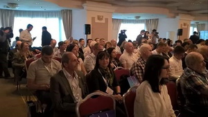
The first international GEODIGITAL UKRAINE 2019 conference on geoinformation technologies brought together a professional community to exchange experiences, launched a platform for combining practical business solutions with state needs and laying the foundations for the development of the industry.
The key focus of the conference was an introduction and use of modern geo-technologies for the development and effective management of industry infrastructure. Speakers from Ukraine, the Netherlands, Poland, Hungary, Georgia, Slovenia, France shared world trends in the field with the participants, presented the latest geo-information technologies and demonstrated successful examples of practical geodata integration for solving industry problems.
The event was attended by representatives of state and local authorities of Ukraine and the world, business leaders, potential investors, business, scientists and experts. The speakers included: Olha Trofimtseva, acting minister of Agrarian Policy and Food of Ukraine Lyudmyla Shemelynets, First Deputy Chairman of the Ukrainian State Housing and Cadastre Administration, Roman Chelnokov, Chairman of the Board of Directors of ARC LLC, Sergii Pryschepa, Deputy Head of the Central Administration of Military Topography and Navigation of the Main Directorate for Operational Support of the Armed Forces, Dr. Miklos Gros, Director of Eurosense Kft (Hungary,) Galaktion Hahubia, Head of Project Management of the National Agency of the Public Registry under the Ministry of Justice of Georgia, Eva Surma, Director of the Department of Strategy, External Cooperation and Public and Information of the State Geodesy and Cartography of Poland, Fevzi Ametov, co-founder of Drone.UA
Conference organizers: the State Service of Ukraine for Geodesy, Cartography and Cadastre (Derzhgeokadastr) and Public organization UkrGeo.